
Headline:
Flash Flood Warning issued April 5 at 5:40PM CDT until April 5 at 11:45PM CDT by NWS Nashville TN
Event:
Flash Flood Warning
Urgency:
Immediate
Effective:
April 5, 2025 - 3:40pm
Expires:
April 5, 2025 - 9:45pm
Description:
FFWOHX
The National Weather Service in Nashville has issued a
* Flash Flood Warning for...
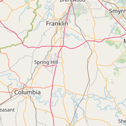
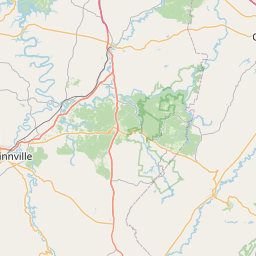
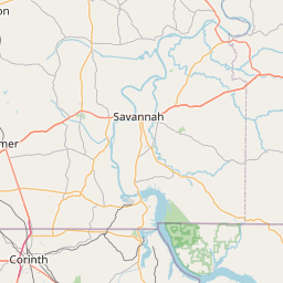
Northern Bedford County in middle Tennessee...
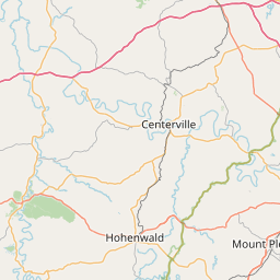
East Central Hickman County in middle Tennessee...
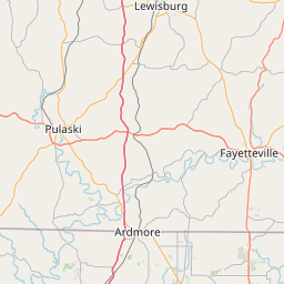
Northeastern Marshall County in middle Tennessee...
Maury County in middle Tennessee...
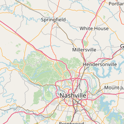
Rutherford County in middle Tennessee...
Williamson County in middle Tennessee...
South Central Wilson County in middle Tennessee...
* Until 1145 PM CDT Saturday.
* At 540 PM CDT, Doppler radar indicated thunderstorms producing
heavy rain across the warned area. Flash flooding is ongoing or
expected to begin shortly.
HAZARD...Flash flooding caused by thunderstorms.
SOURCE...Radar.
IMPACT...Flash flooding of small creeks and streams, urban
areas, highways, streets and underpasses as well as
other poor drainage and low-lying areas.
* Some locations that will experience flash flooding include...
Murfreesboro, Franklin, Columbia, Smyrna, Brentwood, La Vergne,
Spring Hill, Nolensville, Mount Pleasant, Thompson's Station,
Walterhill, Chapel Hill, Eagleville, Triune, Rover, Rockvale,
Unionville, I-65 East Of Columbia, Leipers Fork and Christiana.
Instruction:
Turn around, don't drown when encountering flooded roads. Most flood
deaths occur in vehicles.
Area Description:
Bedford, TN; Hickman, TN; Marshall, TN; Maury, TN; Rutherford, TN; Williamson, TN; Wilson, TN
Forcast Office:
NWS Nashville TN


Leaflet | OSM Mapnik