
Headline:
Flash Flood Warning issued April 5 at 5:42PM CDT until April 5 at 8:30PM CDT by NWS Shreveport LA
Event:
Flash Flood Warning
Urgency:
Immediate
Effective:
April 5, 2025 - 3:42pm
Expires:
April 5, 2025 - 6:30pm
Description:
FFWSHV
The National Weather Service in Shreveport has extended the
* Flash Flood Warning for...
Columbia County in southwestern Arkansas...
Lafayette County in southwestern Arkansas...
Southeastern Miller County in southwestern Arkansas...
Nevada County in southwestern Arkansas...
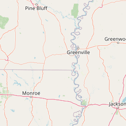
Bossier Parish in northwestern Louisiana...
Caddo Parish in northwestern Louisiana...
Northwestern Claiborne Parish in northwestern Louisiana...
Northwestern Webster Parish in northwestern Louisiana...
* Until 830 PM CDT.
* At 542 PM CDT, Doppler radar indicated thunderstorms producing
heavy rain in Magnolia. Between 2 and 3 inches of rain have
fallen. Additional rainfall amounts up to 1 inch are possible in
the warned area. Flash flooding is ongoing or expected to begin
shortly.
HAZARD...Flash flooding caused by thunderstorms.
SOURCE...Radar indicated.
IMPACT...Flash flooding of small creeks and streams, urban
areas, highways, streets and underpasses as well as
other poor drainage and low-lying areas.
* Some locations that will experience flash flooding include...
Shreveport, Bossier City, Magnolia, Springhill, Stamps, Waldo,
Lewisville, McNeil, Vivian, Greenwood, Blanchard, Haynesville,
Benton, Cullen, Plain Dealing, Cotton Valley, Oil City, Sarepta,
Mooringsport and Bradley.
Instruction:
Turn around, don't drown when encountering flooded roads. Most flood
deaths occur in vehicles.
Area Description:
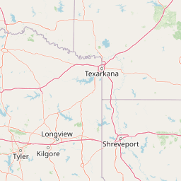
Columbia, AR; Lafayette, AR; Miller, AR; Nevada, AR; Bossier, LA; Caddo, LA; Claiborne, LA; Webster, LA
Forcast Office:
NWS Shreveport LA
Leaflet | OSM Mapnik