
Headline:
Flash Flood Warning issued April 5 at 8:05PM CDT until April 6 at 1:00AM CDT by NWS Jackson MS
Event:
Flash Flood Warning
Urgency:
Immediate
Effective:
April 5, 2025 - 6:05pm
Expires:
April 5, 2025 - 11:00pm
Description:
FFWJAN
The National Weather Service in Jackson has issued a
* Flash Flood Warning for...
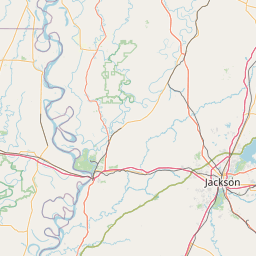
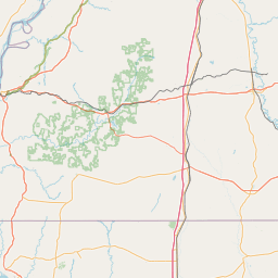
Northwestern East Carroll Parish in northeastern Louisiana...
Northern Franklin Parish in northeastern Louisiana...
Morehouse Parish in northeastern Louisiana...
Richland Parish in northeastern Louisiana...
West Carroll Parish in northeastern Louisiana...
* Until 100 AM CDT.
* At 805 PM CDT, Doppler radar indicated thunderstorms producing
heavy rain across the warned area. Between 1 and 3 inches of rain
have fallen. Additional rainfall amounts of 2 to 3 inches are
possible in the warned area. Flash flooding is ongoing or expected
to begin shortly.
HAZARD...Flash flooding caused by thunderstorms.
SOURCE...Radar.
IMPACT...Flash flooding of small creeks and streams, urban
areas, highways, streets and underpasses as well as
other poor drainage and low-lying areas.
* Some locations that will experience flash flooding include...
Bastrop, Winnsboro, Rayville, Delhi, Oak Grove, Epps, Mangham, Mer
Rouge, Kilbourne, Forest, Collinston, Bonita, Baskin, Pioneer, Oak
Ridge, Holly Ridge, Goodwill, Start, Warden and Galion.
Instruction:
Turn around, don't drown when encountering flooded roads. Most flood
deaths occur in vehicles.
Area Description:
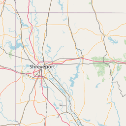
East Carroll, LA; Franklin, LA; Morehouse, LA; Richland, LA; West Carroll, LA
Forcast Office:
NWS Jackson MS


Leaflet | OSM Mapnik