
Headline:
Flash Flood Warning issued April 5 at 11:57PM EDT until April 6 at 2:00AM EDT by NWS Louisville KY
Event:
Flash Flood Warning
Urgency:
Immediate
Effective:
April 5, 2025 - 8:57pm
Expires:
April 5, 2025 - 11:00pm
Description:
FFWLMK
The National Weather Service in Louisville has extended the
* Flash Flood Warning for...
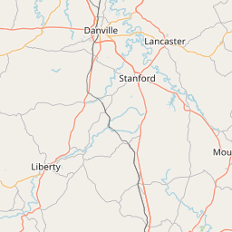
Boyle County in central Kentucky...
Marion County in central Kentucky...
Mercer County in central Kentucky...
Washington County in central Kentucky...
* Until 200 AM EDT.
* At 1157 PM EDT, Doppler radar and automated rain gauges indicated
thunderstorms producing heavy rain across the warned area.
Additional rainfall amounts of 0.5 to 1 inch are possible in the
warned area. Flash flooding is ongoing or expected to begin
shortly.
HAZARD...Flash flooding caused by thunderstorms.
SOURCE...Radar and automated gauges.
IMPACT...Flash flooding of small creeks and streams, urban
areas, highways, streets and underpasses as well as
other poor drainage and low-lying areas.
* Some locations that will experience flash flooding include...
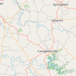
Danville, Harrodsburg, Lebanon, Springfield, Junction City,
Burgin, Perryville, Loretto, Bradfordsville and Willisburg.
Instruction:
Turn around, don't drown when encountering flooded roads. Most flood
deaths occur in vehicles.
Area Description:
Boyle, KY; Marion, KY; Mercer, KY; Washington, KY
Forcast Office:
NWS Louisville KY
Leaflet | OSM Mapnik