
Headline:
Flash Flood Warning issued April 6 at 7:06PM CDT until April 6 at 9:00PM CDT by NWS Mobile AL
Event:
Flash Flood Warning
Urgency:
Immediate
Effective:
April 6, 2025 - 5:06pm
Expires:
April 6, 2025 - 7:00pm
Description:
FFWMOB
The National Weather Service in Mobile has extended the
* Flash Flood Warning for...
Central Mobile County in southwestern Alabama...
* Until 900 PM CDT.
* At 706 PM CDT, the public reported thunderstorms producing heavy
rain across the warned area. Between 6 and 8 inches of rain have
fallen. Additional rainfall amounts up to 1 inch are possible in
the warned area. Flash flooding is already occurring.
HAZARD...Life threatening flash flooding. Thunderstorms
producing flash flooding.
SOURCE...Public reported.
IMPACT...Life threatening flash flooding of creeks and streams,
urban areas, highways, streets and underpasses.
* Some locations that will experience flash flooding include...
Midtown Mobile, Downtown Mobile, Prichard, Tillmans Corner,
Chickasaw, Mobile Regional Airport, I10 And I65, I65 And I165,
West Hill, Wheelerville, Orchard, Forest Hill, Mann, Tacon, Navco,
Meadow Lake, Dawes, Mertz, Neshota and Eight Mile.
Instruction:
Turn around, don't drown when encountering flooded roads. Most flood
deaths occur in vehicles.
Be aware of your surroundings and do not drive on flooded roads.
Area Description:
Mobile, AL
Forcast Office:
NWS Mobile AL
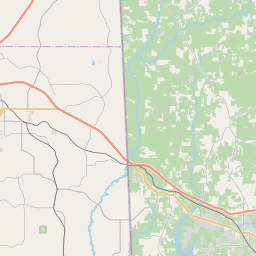
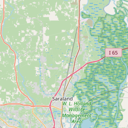


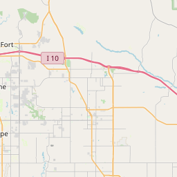


Leaflet | OSM Mapnik