
Headline:
Flood Warning issued April 4 at 10:23PM CDT by NWS Little Rock AR
Event:
Flood Warning
Urgency:
Immediate
Effective:
April 4, 2025 - 8:23pm
Expires:
April 5, 2025 - 8:30pm
Description:
...The Flood Warning is extended for the following river in
Arkansas...
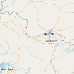
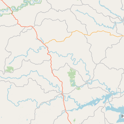
White River At Augusta affecting White and Woodruff Counties.
White River At Calico Rock affecting Stone and Izard Counties.
...The Flood Warning continues for the following rivers in
Arkansas...
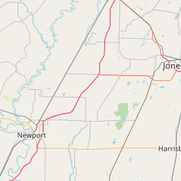
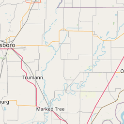
White River At Newport affecting Jackson and Independence
Counties.
White River At Georgetown affecting White, Prairie and Woodruff
Counties.
White River At Clarendon affecting Monroe and Arkansas Counties.
White River At Des Arc affecting Prairie County.
For the Lower White River...including Newport, Augusta, Georgetown,
Des Arc, Clarendon...Major flooding is forecast.
For the Upper White River...including Calico Rock, Batesville...
Major flooding is forecast.
* WHAT...Major flooding is forecast.
* WHERE...White River at Newport.
* WHEN...From Saturday afternoon until further notice.
* IMPACTS...At 34.0 feet, White River crested in December 1982 and
March 2008 at 34 feet. Railroad Bridge downstream of Newport
overtopped. Serious flooding in Jacksonport and Newport. Homes
along State Highway 14 are flooded. Village Creek backing into
portions of Newport. These crest are the highest since completion
of Bull Shoals Dam in 1951. State Highways 14, 37, 69, 122, 367,
and 384 all affected.
* ADDITIONAL DETAILS...
- At 10:00 PM CDT Friday the stage was 14.4 feet.
- Forecast...The river is expected to rise above flood stage
Saturday afternoon and continue rising to a crest of 34.0
feet Tuesday morning.
- Flood stage is 26.0 feet.
- http://www.weather.gov/safety/flood
Instruction:
Turn around, don't drown when encountering flooded roads. Most flood
deaths occur in vehicles.
Please report observed flooding to local emergency services or law
enforcement and request they pass this information to the National
Weather Service when you can do so safely.
Motorists should not attempt to drive around barricades or drive
cars through flooded areas.
River forecasts are based on current conditions and rainfall
forecasted to occur over the next 24 hours. During periods of
flooding...Evening forecasts are reissued with updated rainfall
forecasts.
Observed and forecasted stage data plots are available on our
Advanced Hydrologic Prediction Service web page at...
www.weather.gov/lzk
Under the Current Conditions section...Select River and Lakes AHPS.
The next statement will be issued Saturday evening at 1030 PM CDT.
Area Description:
Independence, AR; Jackson, AR
Forcast Office:
NWS Little Rock AR
Leaflet | OSM Mapnik