
Headline:
Flood Warning issued April 6 at 7:51AM CDT until April 6 at 8:00PM CDT by NWS Springfield MO
Event:
Flood Warning
Urgency:
Expected
Effective:
April 6, 2025 - 5:51am
Expires:
April 6, 2025 - 6:00pm
Description:
* WHAT...Flooding caused by excessive rainfall continues.
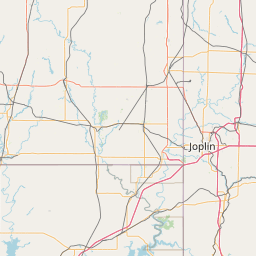
* WHERE...Portions of south central and southwest Missouri,
including the following counties, in south central Missouri,
Howell, Oregon, Shannon and Texas. In southwest Missouri, Douglas
and Ozark.
* WHEN...Until 800 PM CDT Sunday.
* IMPACTS...Flooding of rivers, creeks, streams, and other low-lying
and flood-prone locations is imminent or occurring. Numerous roads
remain closed due to flooding.
* ADDITIONAL DETAILS...
- At 749 AM CDT, The Department of Transportation reported
flooding from previous heavy rain in the warned area. Between
5.5 and 10.5 inches of rain have fallen.
- This includes the following low water crossings...
Lick Creek at County Road 528, South Fork Jacks Fork River at
Stillhouse Road, Big Creek at County Road 390, Warm Fork
Spring River at County Road 323, Howell Creek at County Road
9790, Mahans Creek at County Road 501 and North Fork River at
County Road 278.
- Some locations that will experience flooding include...
West Plains, Mountain View, Thayer, Willow Springs, Winona,
Alton, Gainesville, Birch Tree, Eminence, Summersville,
Bakersfield, Pomona, South Fork, Koshkonong, Pontiac,
Brandsville, Montier, Thomasville, Peace Valley, White
Church, Teresita, Rover, Pine Crest, Arroll, Clear Springs,
Greer, Alley Spring, Eunice, Lanton, Pottersville, Hartshorn,
Siloam Springs, West Eminence, Couch, Moody, Caulfield, Round
Spring, Akers, Dora and Wilderness.
- http://www.weather.gov/safety/flood
Instruction:
Turn around, don't drown when encountering flooded roads. Many flood
deaths occur in vehicles.
Area Description:
Douglas, MO; Howell, MO; Oregon, MO; Ozark, MO; Shannon, MO; Texas, MO
Forcast Office:
NWS Springfield MO


Leaflet | OSM Mapnik