
Headline:
Flood Warning issued April 6 at 9:33AM CDT until April 7 at 11:00AM CDT by NWS Louisville KY
Event:
Flood Warning
Urgency:
Expected
Effective:
April 6, 2025 - 7:33am
Expires:
April 7, 2025 - 9:00am
Description:
* WHAT...Flooding caused by excessive rainfall continues.
* WHERE...Portions of central and south central Kentucky, including
the following counties, in central Kentucky, Casey, Grayson,
Green, Hardin, Hart, Larue, Marion, Nelson, Ohio and Taylor. In
south central Kentucky, Adair, Allen, Barren, Butler, Clinton,
Cumberland, Edmonson, Logan, Metcalfe, Monroe, Russell, Simpson
and Warren.
* WHEN...Until 1100 AM CDT /noon EDT/ Monday.
* IMPACTS...Flooding of rivers, creeks, streams, and other low-lying
and flood-prone locations is imminent or occurring. Numerous roads
remain closed due to flooding. Streams continue to rise due to
excess runoff from earlier rainfall. Low-water crossings are
inundated with water and may not be passable. Expect many areas of
slow moving or standing water.
* ADDITIONAL DETAILS...
- At 932 AM CDT /1032 AM EDT/, Light to occasionally moderate
rainfall will continue across the region through this
evening. However, flooding will continue across the warning
area through Monday morning.
- Some locations that will experience flooding include...
Bowling Green, Liberty, Glasgow, Campbellsville,
Russellville, Lebanon, Columbia, Scottsville, Hodgenville and
Tompkinsville.
- http://www.weather.gov/safety/flood
Instruction:
Turn around, don't drown when encountering flooded roads. Most flood
deaths occur in vehicles.
Area Description:
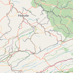
Adair, KY; Allen, KY; Barren, KY; Butler, KY; Casey, KY; Clinton, KY; Cumberland, KY; Edmonson, KY; Grayson, KY; Green, KY; Hardin, KY; Hart, KY; Larue, KY; Logan, KY; Marion, KY; Metcalfe, KY; Monroe, KY; Nelson, KY; Ohio, KY; Russell, KY; Simpson, KY; Taylor, KY; Warren, KY
Forcast Office:
NWS Louisville KY


Leaflet | OSM Mapnik