
Headline:
Flood Warning issued April 6 at 12:22PM EDT by NWS Northern Indiana
Event:
Flood Warning
Urgency:
Immediate
Effective:
April 6, 2025 - 9:22am
Expires:
April 7, 2025 - 3:30am
Description:
...The Flood Warning continues for the following rivers in Ohio...
Indiana...
Auglaize River near Fort Jennings affecting Paulding, Allen OH
and Putnam Counties.
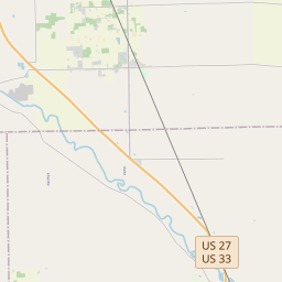
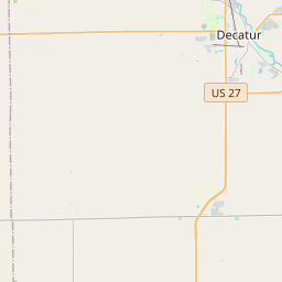
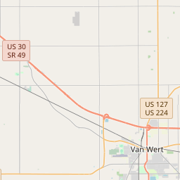
Saint Marys River near Decatur affecting Adams, Van Wert and
Allen IN Counties.
...The Flood Warning is extended for the following rivers in Ohio...
Indiana...
Blanchard River at Ottawa affecting Putnam County.
Maumee River near Defiance affecting Henry and Defiance Counties.
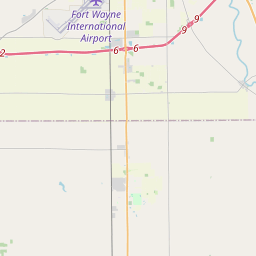
Maumee River at Fort Wayne affecting Paulding and Allen IN
Counties.
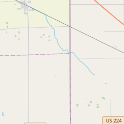
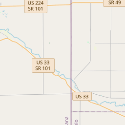
Saint Joseph River Ohio below Montpelier affecting Williams
County.
Saint Joseph River Ohio near Newville affecting De Kalb, Defiance
and Allen IN Counties.
Tiffin River at Stryker affecting Williams, Defiance and Fulton
OH Counties.
...The Flood Warning is cancelled for the following rivers in Ohio...
Maumee River at Napoleon affecting Henry County.
For the Auglaize River...including Fort Jennings, Defiance...Minor
flooding is forecast.
For the Blanchard River...including Ottawa...Minor flooding is
forecast.
For the Maumee River...including Fort Wayne, Defiance, Napoleon...
Minor flooding is forecast.
For the Saint Joseph River Ohio...including Montpelier, Newville,
St. Joe River Ft. Wayne...Moderate flooding is forecast.
For the Saint Marys River...including Decatur, St. Mary's River near
Fort Wayne...Minor flooding is forecast.
For the Tiffin River...including Stryker...Minor flooding is
forecast.
* WHAT...Minor flooding is occurring and minor flooding is forecast.
* WHERE...Saint Marys River near Decatur.
* WHEN...Until further notice.
* IMPACTS...At 19.5 feet, Flooding expands into more farm land in
the Decatur area. Flood waters approach Piqua Road...Ohio State
Route 49 and Indiana 101 just north of Pleasant Mills. Flood water
begins to cross Ohio highway 49 north of Willshire, Ohio.
* ADDITIONAL DETAILS...
- At 11:55 AM EDT Sunday the stage was 19.7 feet.
- Recent Activity...The maximum river stage in the 24 hours
ending at 11:55 AM EDT Sunday was 19.7 feet.
- Forecast...The river is expected to rise to a crest of 19.9
feet this evening.
- Flood stage is 17.0 feet.
- http://www.weather.gov/safety/flood
Instruction:
Turn around, don't drown when encountering flooded roads. Most flood
deaths occur in vehicles.
Be especially cautious at night when it is harder to recognize the
dangers of flooding.
Motorists should not attempt to drive around barricades or drive
cars through flooded areas.
Detailed river forecasts and additional information can be found at
www.weather.gov/iwx under Rivers and Lakes.
The next statement will be issued this afternoon at 130 PM EDT.
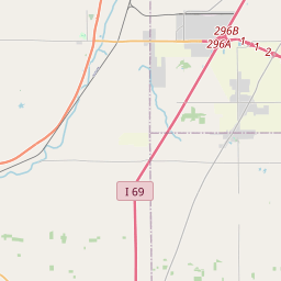
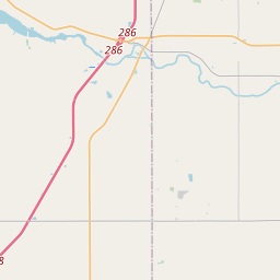
Area Description:
Adams, IN; Allen, IN; Van Wert, OH
Forcast Office:
NWS Northern Indiana


Leaflet | OSM Mapnik