
Headline:
Flood Warning issued April 12 at 10:52AM CDT by NWS Little Rock AR
Event:
Flood Warning
Urgency:
Immediate
Effective:
April 12, 2025 - 8:52am
Expires:
April 13, 2025 - 9:00am
Description:
...The Flood Warning continues for the following river in Arkansas...
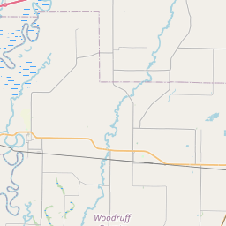
White River At Georgetown affecting Prairie, Woodruff and White
Counties.
For the Lower White River...including Newport, Augusta, Georgetown,
Des Arc, Clarendon...Major flooding is forecast.
* WHAT...Major flooding is occurring and major flooding is forecast.
* WHERE...White River at Georgetown.
* WHEN...Until further notice.
* IMPACTS...At 21.0 feet, Hurricane Lake Wildlife Management Area
and Raft Creek Bottoms inundated. Roads in the bottoms are flooded.
At 22.0 feet, Farm fields and farm roads on either side of Highway
36 west of Georgetown inundated.
At 23.0 feet, Minor street flooding in Georgetown including Heath
Scott Drive and Riverside Street near the boat ramp.
At 24.0 feet, State Highway 36 to Georgetown may be flooding due
to backwater up Little Red River, especially during locally heavy
rainfall or high White River stage. Levee on north side of the
Little Red River protecting the Bald Knob National Wildlife
Refuge, primarily cropland, may be over-topped.
At 26.0 feet, Backwater up Little Red River floods bottomland near
West Point and Georgetown. Numerous roads and bridges flooded west
of the river. Extensive area of cropland in White, Woodruff, and
Prairie counties flooded. State Highway 36 is probably flooded and
impassable. Georgetown and Nimmo could be isolated by floodwater.
Residents should either leave or have provisions for a prolonged
stay.
At 28.0 feet, Levees along South Bank of Little Red River
protecting cropland and the National Wildlife Refuge is possibly
overtopped. Water runs around lower end of levee system. Homes
flooded near Nimmo, near West Point, and in the Georgetown
vicinity. Georgetown is isolated by floodwater. Residents should
leave, or have provisions for a prolonged stay.
* ADDITIONAL DETAILS...
- At 10:00 AM CDT Saturday the stage was 28.1 feet.
- Forecast...The river is expected to fall to 27.7 feet by
Monday afternoon (April 14), but remain in moderate flood
stage.
- Flood stage is 21.0 feet.
- http://www.weather.gov/safety/flood
Instruction:
Motorists should not attempt to drive around barricades or drive
cars through flooded areas.
Flooding is occurring or is imminent. Most flood related deaths
occur in automobiles. Do not attempt to cross water covered bridges,
dips, or low water crossings. Never try to cross a flowing stream,
even a small one, on foot. To escape rising water find another route
over higher ground.
Turn around, don't drown when encountering flooded roads. Most flood
deaths occur in vehicles.
River forecasts are based on current conditions and rainfall
forecasted to occur over the next 24 hours. During periods of
flooding...Evening forecasts are reissued with updated rainfall
forecasts.
Observed and forecasted stage data plots are available on our
Advanced Hydrologic Prediction Service web page at...
www.weather.gov/lzk
Under the Current Conditions section...Select River and Lakes AHPS.
The next statement will be issued Sunday morning at 1100 AM CDT.
Area Description:
Prairie, AR; White, AR; Woodruff, AR
Forcast Office:
NWS Little Rock AR


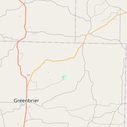
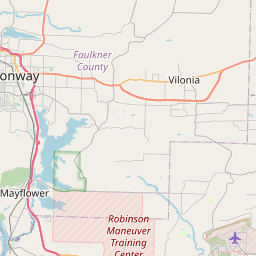
Leaflet | OSM Mapnik