
Headline:
Flood Warning issued April 13 at 9:44AM CDT until April 18 at 3:01AM CDT by NWS Little Rock AR
Event:
Flood Warning
Urgency:
Immediate
Effective:
April 13, 2025 - 7:44am
Expires:
April 14, 2025 - 7:45am
Description:
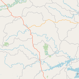
...The Flood Warning continues for the following river in Arkansas...
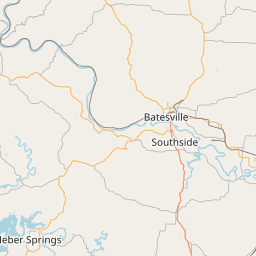
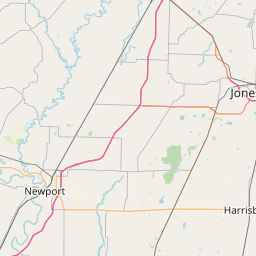
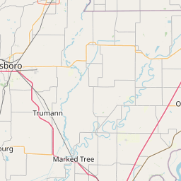
White River At Newport affecting Independence and Jackson
Counties.
For the Lower White River...including Newport, Augusta, Georgetown,
Des Arc, Clarendon...Major flooding is forecast.
* WHAT...Moderate flooding is occurring and moderate flooding is
forecast.
* WHERE...White River at Newport.
* WHEN...Until early Friday morning.
* IMPACTS...At 21.0 feet, Corps regulation stage during the winter
months for Bull Shoals and Norfork Reservoir releases.
At 26.0 feet, Many thousands of acres of cropland are inundated.
Water is near State Highway 14. Many private levees are
over-topped allowing the river to flood cropland. Water in
portions of Jacksonport State Park that are on river side of levee.
At 27.0 feet, State Highway 14 between Newport and Oil Trough and
State Highway 122 to Newark affected. Possible structural flooding
along State Highway 14 in Independence County. Bateman Levee
patrolling begins.
At 28.0 feet, Bateman Levee may be threatened with over-topping.
State Highway 14 east of Newport at Village Creek could be flooded
by backwater. State Highway 14 west of Newport is flooded. State
Highway 69 in Independence County may be flooded. Flooding up
Village Creek extends to eastern portions of Newport. Extensive
flooding of cropland in Jackson and Independence County along the
White and the lower Black River. River crested slightly above 28
feet in December 2001 and March 2002.
* ADDITIONAL DETAILS...
- At 9:00 AM CDT Sunday the stage was 28.5 feet.
- Forecast...The river is expected to rise to a crest of 28.6
feet this afternoon (April 13), then begin to fall to 27.4
feet by Tuesday morning (April 15), but remain in minor flood
stage.
- Flood stage is 26.0 feet.
- http://www.weather.gov/safety/flood
Instruction:
Turn around, don't drown when encountering flooded roads. Most flood
deaths occur in vehicles.
Flooding is occurring or is imminent. Most flood related deaths
occur in automobiles. Do not attempt to cross water covered bridges,
dips, or low water crossings. Never try to cross a flowing stream,
even a small one, on foot. To escape rising water find another route
over higher ground.
Motorists should not attempt to drive around barricades or drive
cars through flooded areas.
River forecasts are based on current conditions and rainfall
forecasted to occur over the next 24 hours. During periods of
flooding...Evening forecasts are reissued with updated rainfall
forecasts.
Observed and forecasted stage data plots are available on our
Advanced Hydrologic Prediction Service web page at...
www.weather.gov/lzk
Under the Current Conditions section...Select River and Lakes AHPS.
The next statement will be issued Monday morning at 945 AM CDT.
Area Description:
Independence, AR; Jackson, AR
Forcast Office:
NWS Little Rock AR
Leaflet | OSM Mapnik