
Headline:
Flood Warning issued April 14 at 8:46PM CDT by NWS Little Rock AR
Event:
Flood Warning
Urgency:
Immediate
Effective:
April 14, 2025 - 6:46pm
Expires:
April 15, 2025 - 7:00pm
Description:
...The Flood Warning continues for the following rivers in
Arkansas...
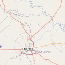
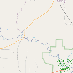
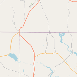
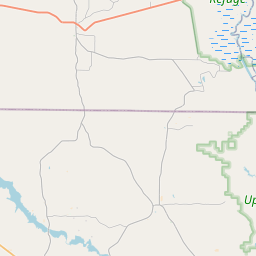
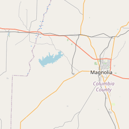
Ouachita River At Thatcher L&D affecting Bradley, Union and
Calhoun Counties.
Ouachita River At Camden affecting Ouachita and Calhoun Counties.
For the Ouachita River...including Jones Mill Dcp, Arkadelphia,
Camden, Thatcher L&D...Moderate flooding is forecast.
* WHAT...Moderate flooding is occurring and moderate flooding is
forecast.
* WHERE...Ouachita River at Thatcher L&D.
* WHEN...Until further notice.
* IMPACTS...At 79.0 feet, Property in low lying areas needs to be
removed. Access roads to oil and gas rigs may be flooded. Levee
gates should be closed before the river reaches 80 feet. There is
minor flooding at this level.
At 80.0 feet, Minor flooding occurs at this level. Levee gates
should be closed to prevent the river from backing into Calion
Lake. Access to oil and gas rigs and to timber is flooded. There
is wide coverage of flooding in the river bottoms.
At 83.0 feet, Access to oil and gas rigs and to timber is flooded.
Calhoun County Road 131 is completely under water leading to old
Lock 8 river access.
At 85.0 feet, There may be some County roads along the river
flooded, requiring lengthy detours. River is high and swift,
boaters should be very cautious. Access to many oil and gas rigs
will be by boat only. Levee gates should be closed.
At 88.0 feet, River is high enough to stop drainage from Calion
Lake. Heavy rainfall in the area could cause the lake to rise
towards several homes along the shore. Downstream, water rising
into undeveloped areas of the State Park at Moro Bay. Widespread
flooding of timber, with access to many oil and gas rigs flooded.
At 90.0 feet, Access to Thatcher Lock and Dam may be affected.
Many oil and gas rigs in the river bottoms can be reached by boat
only. Runoff into Calion Lake cannot drain to the river. Levee
gates should be closed. Downstream, minor impacts to the Moro Bay
State Park, some shallow water may be over the road to the
campground.
* ADDITIONAL DETAILS...
- At 7:30 PM CDT Monday the stage was 90.2 feet.
- Forecast...The river is expected to fall to 85.3 feet
Saturday evening.
- Flood stage is 79.0 feet.
- http://www.weather.gov/safety/flood
Instruction:
Turn around, don't drown when encountering flooded roads. Most flood
deaths occur in vehicles.
Motorists should not attempt to drive around barricades or drive
cars through flooded areas.
River forecasts are based on current conditions and rainfall
forecasted to occur over the next 24 hours. During periods of
flooding...Evening forecasts are reissued with updated rainfall
forecasts.
Observed and forecasted stage data plots are available on our
Advanced Hydrologic Prediction Service web page at...
www.weather.gov/lzk
Under the Current Conditions section...Select River and Lakes AHPS.
The next statement will be issued Tuesday evening at 900 PM CDT.
Area Description:
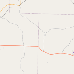
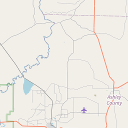
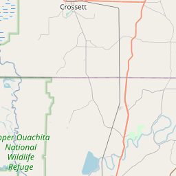
Bradley, AR; Calhoun, AR; Union, AR
Forcast Office:
NWS Little Rock AR
Leaflet | OSM Mapnik