
Headline:
Severe Thunderstorm Warning issued March 31 at 2:13AM CDT until March 31 at 3:00AM CDT by NWS Memphis TN
Event:
Severe Thunderstorm Warning
Urgency:
Immediate
Effective:
March 31, 2025 - 12:13am
Expires:
March 31, 2025 - 1:00am
Description:
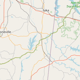
At 213 AM CDT, a severe thunderstorm was located near Booneville,
moving east at 25 mph.
HAZARD...60 mph wind gusts and quarter size hail.
SOURCE...Radar indicated.
IMPACT...Hail damage to vehicles is expected. Expect wind damage to
roofs, siding, and trees.
Locations impacted include...
Iuka, Oldham, Thrasher, Dennis, Belmont, Paden, Blythe Crossing,
Thrashers, Carter Branch, Burton, Hazard Switch, Walker Siding,
Holcut, Midway, Hobo Station, Holts Spur, Petertown, Neil, Leedy, and
Tishomingo.
Instruction:
A Tornado Watch remains in effect until 500 AM CDT for northeastern
Mississippi.
Remain alert for a possible tornado! Tornadoes can develop quickly
from severe thunderstorms. If you spot a tornado go at once into the
storm shelter or small central room in a sturdy structure.
For your protection move to an interior room on the lowest floor of a
building.
Area Description:
Alcorn, MS; Prentiss, MS; Tishomingo, MS
Forcast Office:
NWS Memphis TN


Leaflet | OSM Mapnik