
Headline:
Severe Thunderstorm Warning issued April 2 at 5:06PM CDT until April 2 at 5:45PM CDT by NWS Memphis TN
Event:
Severe Thunderstorm Warning
Urgency:
Immediate
Effective:
April 2, 2025 - 3:06pm
Expires:
April 2, 2025 - 3:45pm
Description:
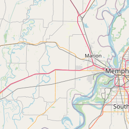
At 506 PM CDT, a severe thunderstorm was located over Olive Branch,
moving northeast at 50 mph.
HAZARD...Ping pong ball size hail and 60 mph wind gusts.
SOURCE...Radar indicated. At 503 PM CDT, golf ball sized hail was
reported near Nesbit along Interstate 269.
IMPACT...People and animals outdoors will be injured. Expect hail
damage to roofs, siding, windows, and vehicles. Expect wind
damage to roofs, siding, and trees.
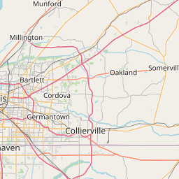
Locations impacted include...
Piperton, Lenow, Cockrum, Cedarview, Ellendale, Oakland, Germantown,
Bright, Nesbit, Handy Corner, Warren, Capleville, Kirk, Hickory
Withe, Jago, Arlington, Elmore Park, Brunswick, Fisherville, and
Collierville.
Instruction:
A Tornado Watch remains in effect until midnight CDT for northwestern
Mississippi...and west Tennessee.
For your protection move to an interior room on the lowest floor of a
building.
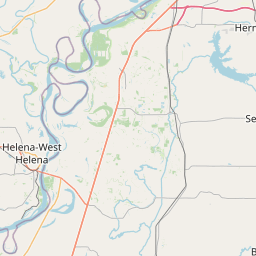
Area Description:
DeSoto, MS; Marshall, MS; Fayette, TN; Shelby, TN
Forcast Office:
NWS Memphis TN

Leaflet | OSM Mapnik