
Headline:
Severe Thunderstorm Warning issued April 4 at 3:58AM CDT until April 4 at 4:30AM CDT by NWS Norman OK
Event:
Severe Thunderstorm Warning
Urgency:
Immediate
Effective:
April 4, 2025 - 1:58am
Expires:
April 4, 2025 - 2:30am
Description:
SVROUN
The National Weather Service in Norman has issued a
* Severe Thunderstorm Warning for...
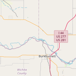
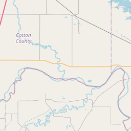
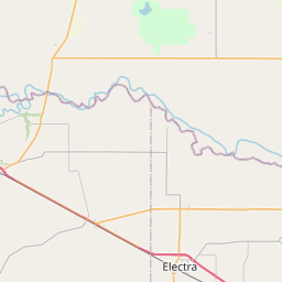
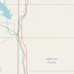
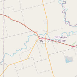
Northern Clay County in northern Texas...
Southeastern Wichita County in northern Texas...
* Until 430 AM CDT.
* At 357 AM CDT, severe thunderstorms were located along a line
extending from near Iowa Park to the southwest side of Wichita
Falls, moving northeast at 55 mph. 62 mph winds have been reported
with this storm on the west side of Wichita Falls.
HAZARD...60 mph wind gusts.
SOURCE...Radar indicated.
IMPACT...Expect damage to roofs, siding, and trees.
* Locations impacted include...
Wichita Falls, Sheppard AFB, Iowa Park, Jolly, Byers, Pleasant
Valley, Charlie, Cashion, Petrolia, and Dean.
Instruction:
For your protection move to an interior room on the lowest floor of a
building.
Area Description:
Clay, TX; Wichita, TX
Forcast Office:
NWS Norman OK


Leaflet | OSM Mapnik