
Headline:
Severe Thunderstorm Warning issued April 5 at 2:24PM CDT until April 5 at 3:00PM CDT by NWS Nashville TN
Event:
Severe Thunderstorm Warning
Urgency:
Immediate
Effective:
April 5, 2025 - 12:24pm
Expires:
April 5, 2025 - 1:00pm
Description:
SVROHX
The National Weather Service in Nashville has issued a
* Severe Thunderstorm Warning for...
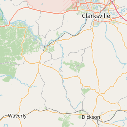
Northwestern Dickson County in Middle Tennessee...
Western Montgomery County in Middle Tennessee...
Southern Stewart County in Middle Tennessee...
Houston County in Middle Tennessee...
Northern Humphreys County in Middle Tennessee...
* Until 300 PM CDT.
* At 223 PM CDT, a severe thunderstorm was located 7 miles east of
Springville, or 12 miles north of Camden, moving east at 55 mph.
HAZARD...60 mph wind gusts and penny size hail.
SOURCE...Radar indicated.
IMPACT...Expect damage to roofs, siding, and trees.
* Locations impacted include...
Erin, Cumberland City, Vanleer, Houston County Airport, Indian
Mound, Palmyra, Slayden, Tennessee Ridge, and Woodlawn.
Instruction:
Remain alert for a possible tornado! Tornadoes can develop quickly
from severe thunderstorms. If you spot a tornado go at once into the
basement or small central room in a sturdy structure.
For your protection move to an interior room on the lowest floor of a
building.
A Tornado Watch remains in effect until 900 PM CDT for Middle
Tennessee.
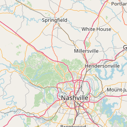
Area Description:
Dickson, TN; Houston, TN; Humphreys, TN; Montgomery, TN; Stewart, TN
Forcast Office:
NWS Nashville TN


Leaflet | OSM Mapnik