
Headline:
Severe Thunderstorm Warning issued April 5 at 4:26PM EDT until April 5 at 5:00PM EDT by NWS Charleston WV
Event:
Severe Thunderstorm Warning
Urgency:
Immediate
Effective:
April 5, 2025 - 1:26pm
Expires:
April 5, 2025 - 2:00pm
Description:
SVRRLX
The National Weather Service in Charleston West Virginia has issued a
* Severe Thunderstorm Warning for...
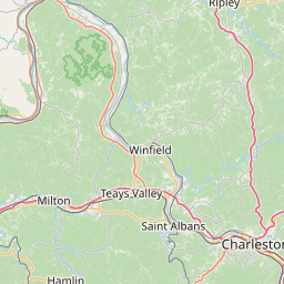
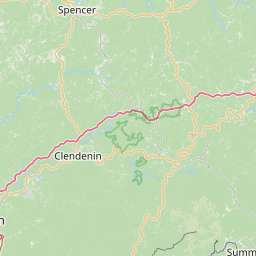
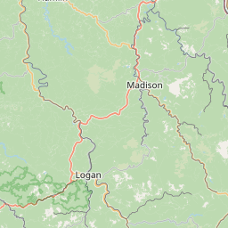
West central Kanawha County in central West Virginia...
Central Lincoln County in central West Virginia...
Northern Boone County in central West Virginia...
* Until 500 PM EDT.
* At 425 PM EDT, a severe thunderstorm was located over
Spurlockville, or 11 miles southeast of Hamlin, moving east at 40
mph.
HAZARD...60 mph wind gusts and half dollar size hail.
SOURCE...Radar indicated.
IMPACT...Hail damage to vehicles is expected. Expect wind damage
to roofs, siding, and trees.
* Locations impacted include...
Charleston, Seth, Sod, Woodville, Ashford, Alum Creek, Palermo,
Danville, Foster, Spurlockville, Alkol, Mud, Yawkey, Racine,
Julian, South Charleston, Marmet, Madison, and Harts.
This includes the following highways...
Interstate 64 in West Virginia near mile marker 57.
Route 119 between mile markers 51 and 80.
Instruction:
Remain alert for a possible tornado! Tornadoes can develop quickly
from severe thunderstorms. If you spot a tornado go at once into the
basement or small central room in a sturdy structure.
For your protection move to an interior room on the lowest floor of a
building.
Torrential rainfall is occurring with this storm, and may lead to
flash flooding. Do not drive your vehicle through flooded roadways.
Area Description:
Boone, WV; Kanawha, WV; Lincoln, WV
Forcast Office:
NWS Charleston WV
Leaflet | OSM Mapnik