
Headline:
Severe Thunderstorm Warning issued April 5 at 5:49PM CDT until April 5 at 6:45PM CDT by NWS Nashville TN
Event:
Severe Thunderstorm Warning
Urgency:
Immediate
Effective:
April 5, 2025 - 3:49pm
Expires:
April 5, 2025 - 4:45pm
Description:
SVROHX
The National Weather Service in Nashville has issued a
* Severe Thunderstorm Warning for...
Northwestern Overton County in Middle Tennessee...
Northeastern Smith County in Middle Tennessee...
Northern Jackson County in Middle Tennessee...
Clay County in Middle Tennessee...
Eastern Macon County in Middle Tennessee...
* Until 645 PM CDT.
* At 549 PM CDT, severe thunderstorms were located along a line
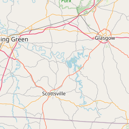
extending from 9 miles southeast of Scottsville to near Lafayette
to near Carthage, moving northeast at 55 mph.
HAZARD...60 mph wind gusts and quarter size hail.
SOURCE...Radar indicated.
IMPACT...Hail damage to vehicles is expected. Expect wind damage
to roofs, siding, and trees.
* Locations impacted include...
Red Boiling Springs, Celina, Whitleyville, Moss, Gainesboro,
Pleasant Shade, Dale Hollow Lake, and Standing Stone State Park.
Instruction:
For your protection move to an interior room on the lowest floor of a
building.
A Tornado Watch remains in effect until 900 PM CDT for Middle
Tennessee.
Area Description:
Clay, TN; Jackson, TN; Macon, TN; Overton, TN; Smith, TN
Forcast Office:
NWS Nashville TN


Leaflet | OSM Mapnik