
Headline:
Severe Thunderstorm Warning issued April 5 at 11:45PM CDT until April 6 at 12:15AM CDT by NWS Jackson MS
Event:
Severe Thunderstorm Warning
Urgency:
Immediate
Effective:
April 5, 2025 - 9:45pm
Expires:
April 5, 2025 - 10:15pm
Description:
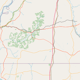
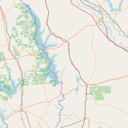
At 1144 PM CDT, severe thunderstorms were located along a line
extending from Durant to near Flora, moving east at 40 mph.
HAZARD...60 mph wind gusts.
SOURCE...Radar indicated.
IMPACT...Expect damage to roofs, siding, and trees.
These severe storms will be near...
Annandale, Jackson, Way, Vaughan, and Canton around 1150 PM CDT.
Gluckstadt around 1155 PM CDT.
Instruction:
A Tornado Watch remains in effect until midnight CDT for central
Mississippi. A Tornado Watch also remains in effect until 500 AM CDT
for central Mississippi.
For your protection move to an interior room on the lowest floor of a
building.
Area Description:
Hinds, MS; Madison, MS; Yazoo, MS
Forcast Office:
NWS Jackson MS


Leaflet | OSM Mapnik