
Headline:
Special Weather Statement issued March 31 at 9:18AM CDT by NWS Birmingham AL
Event:
Special Weather Statement
Urgency:
Expected
Effective:
March 31, 2025 - 7:18am
Expires:
March 31, 2025 - 8:15am
Description:
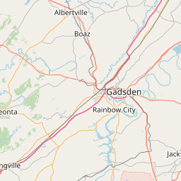
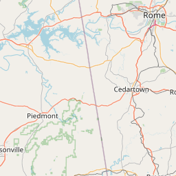
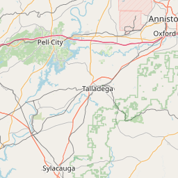
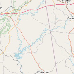
At 918 AM CDT, Doppler radar was tracking strong thunderstorms along
a line extending from near Glencoe to near Logan Martin Lake.
Movement was east at 35 mph.
HAZARD...Wind gusts up to 40 mph and pea size hail.
SOURCE...Radar indicated.
IMPACT...Gusty winds could knock down tree limbs and blow around
unsecured objects. Minor hail damage to vegetation is
possible.
Locations impacted include...
Anniston, Munford, Choccolocco, Talladega Superspeedway, Anniston
Regional Airport, Blue Mountain, Cobb Town, Jackson Shoals, Sulphur
Springs, Jenifer, Hobson City, Alexandria, Lincoln, Talladega
Municipal Airport, Jacksonville, Jacksonville State University,
Oxford, West End-Cobb Town, Wellington, and Anniston Army Depot.
Instruction:
If outdoors, consider seeking shelter inside a building.
A Severe Thunderstorm Watch remains in effect until noon CDT for
central, northeastern and east central Alabama.
Area Description:
Calhoun; Talladega
Forcast Office:
NWS Birmingham AL
Leaflet | OSM Mapnik