
Headline:
Special Weather Statement issued April 1 at 3:23PM PDT by NWS San Francisco CA
Event:
Special Weather Statement
Urgency:
Expected
Effective:
April 1, 2025 - 3:23pm
Expires:
April 1, 2025 - 3:45pm
Description:
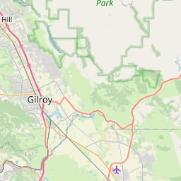
At 323 PM PDT, Doppler radar was tracking a strong thunderstorm over
Gilroy, moving southeast at 35 mph.
HAZARD...Wind gusts up to 40 mph and pea size hail.
SOURCE...Radar indicated.
IMPACT...Gusty winds could knock down tree limbs and blow around
unsecured objects. Minor damage to outdoor objects is possible.
Locations impacted include...
Gilroy and Hollister.
Instruction:
Monitor the weather situation closely and be alert for threatening
weather conditions.
This storm may intensify, so be certain to monitor local radio
stations and available television stations for additional
information and possible warnings from the National Weather Service.
Storms will be capable of producing large quantities of accumulating
hail. This may result in slick and hazardous driving conditions.
Slow down and use caution if driving.
Area Description:
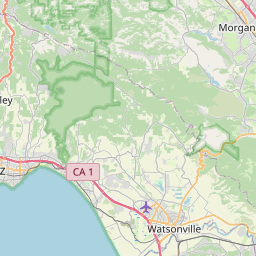
Santa Clara Valley Including San Jose; Eastern Santa Clara Hills; Northern Salinas Valley/Hollister Valley and Carmel Valley
Forcast Office:
NWS San Francisco CA


Leaflet | OSM Mapnik