
Headline:
Special Weather Statement issued April 2 at 1:56PM CDT by NWS Fort Worth TX
Event:
Special Weather Statement
Urgency:
Expected
Effective:
April 2, 2025 - 11:56am
Expires:
April 2, 2025 - 12:30pm
Description:
At 156 PM CDT, Doppler radar was tracking a strong thunderstorm over
Fate, moving northeast at 45 mph.
HAZARD...Winds in excess of 30 mph and penny size hail.
SOURCE...Radar indicated.
IMPACT...Gusty winds could knock down tree limbs and blow around
unsecured objects. Minor damage to outdoor objects is
possible.
This strong thunderstorm will be near...
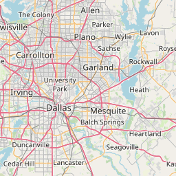
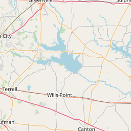
Fate and Royse City around 200 PM CDT.
Caddo Mills around 205 PM CDT.
Greenville around 210 PM CDT.
Greenville City Lakes around 220 PM CDT.
Other locations impacted by this storm include Neylandville, Kellogg,
Center Point, Floyd, Kingston, Josephine, Clinton, Nevada, Union
Valley, and McLendon-Chisholm.
This includes Interstate 30 between mile markers 69 and 102.
Instruction:
If outdoors, consider seeking shelter inside a building.
Area Description:
Collin; Hunt; Rockwall
Forcast Office:
NWS Fort Worth TX
Leaflet | OSM Mapnik