
Headline:
Special Weather Statement issued April 5 at 9:50PM CDT by NWS Jackson MS
Event:
Special Weather Statement
Urgency:
Expected
Effective:
April 5, 2025 - 7:50pm
Expires:
April 5, 2025 - 8:45pm
Description:
At 950 PM CDT, Doppler radar was tracking a cluster of strong
thunderstorms over Mansford, or near Tallulah, moving east at 40 mph.
HAZARD...Wind gusts up to 50 mph.
SOURCE...Radar indicated.
IMPACT...Gusty winds could knock down tree limbs and blow around
unsecured objects.
This strong thunderstorm will be near...
Eagle Bend around 955 PM CDT.
Vicksburg around 1000 PM CDT.
Redwood around 1005 PM CDT.
Oak Ridge around 1015 PM CDT.
Youngton around 1025 PM CDT.
Phoenix around 1030 PM CDT.
Other locations impacted by this storm include Delta and Richmond.
Instruction:
If outdoors, consider seeking shelter inside a building.
Torrential rainfall is also occurring with this storm and may lead to
localized flooding. Do not drive your vehicle through flooded
roadways.
A Tornado Watch remains in effect until midnight CDT for northeastern
Louisiana...and central and west central Mississippi.
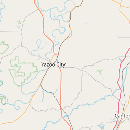
Area Description:
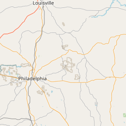
East Carroll; Madison; Issaquena; Yazoo; Warren; Hinds
Forcast Office:
NWS Jackson MS


Leaflet | OSM Mapnik