
Headline:
Special Weather Statement issued April 25 at 2:56AM MDT by NWS Pueblo CO
Event:
Special Weather Statement
Urgency:
Expected
Effective:
April 25, 2025 - 1:56am
Expires:
April 25, 2025 - 2:30am
Description:
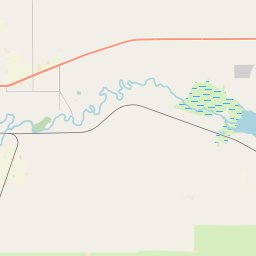
At 256 AM MDT, Doppler radar was tracking a strong thunderstorm over
John Martin Reservoir, or 24 miles east of North La Junta, moving
northeast at 10 mph.
HAZARD...Wind gusts up to 40 mph and nickel size hail.
SOURCE...Radar indicated.
IMPACT...Gusty winds could knock down tree limbs and blow around
unsecured objects. Minor hail damage to vegetation is
possible.
Locations impacted include...
John Martin Reservoir.
Instruction:
If outdoors, consider seeking shelter inside a building.
Torrential rainfall is also occurring with this storm and may lead to
localized flooding. Do not drive your vehicle through flooded
roadways.
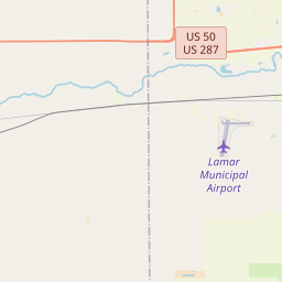
Area Description:
Las Animas Vicinity/Bent County
Forcast Office:
NWS Pueblo CO

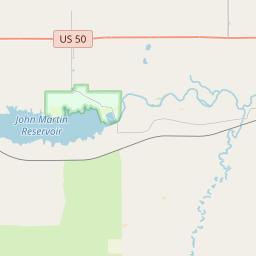


Leaflet | OSM Mapnik